NORBIT Equipment
NORBIT iLiDAR laser
Terrestrial LiDAR sensor fully integrated with NORBIT multibeam systems, capturing 300,000 points per second above water alongside bathymetry.
Description
The NORBIT iLiDAR is a terrestrial mapping sensor fully integrated with a high-resolution bathymetric multibeam system. It captures 300,000 data points per second, mapping above-water terrain alongside the bathymetry in a single pass. A single cable connects the IP67 sensor head to the topside Sonar Interface Unit.
Key features
- Hardware time synchronisation
- Full integration with iWBMS
- 360° field of view
- Weight under 3 kg
- Options: pole mount, top-end INS (0.01°) and acquisition software
Applications
- Harbour and river surveys
- Height clearance under bridges and transmission lines
- Beach nourishment and shoreline charting
- Aquaculture, dredging and rock dumping
Specifications
| Data rate | 300,000 points/s |
|---|---|
| Field of view | 360° |
| Weight | < 3 kg |
| Ingress protection | IP67 |
More from NORBIT
- NORBIT WINGHEAD WINGHEAD X Midwater
- NORBIT WINGHEAD WINGHEAD X
- NORBIT WINGHEAD WINGHEAD B59S
- NORBIT WINGHEAD WINGHEAD B43
- NORBIT WINGHEAD WINGHEAD B44 Deep Sea and Full Ocean
- NORBIT WINGHEAD WINGHEAD F11 and WINGHEAD F11 Deep Sea
- NORBIT WBMS WBMS X
- NORBIT WBMS WBMS Basic (depth rated)
- NORBIT WBMS WBMS FLS - Compact and Wide
- NORBIT Sub-Bottom Profiler (iSBP)
- NORBIT Carbon Fibre Mounting Pole (PORTUS)
- NORBIT Data Collection Tool (DCT)
Featured products
All products →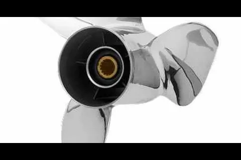
Component
Powertech OFX3 3-Blade Offshore Stainless Propellers
Powertech OFX3 3-blade stainless propellers, 15.25 in diameter, 14–28 in pitch, RH/LH, for 4.75 in gearcase; aggressive cup, high rake and X-cut geometry.
Other product
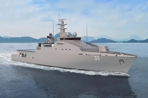
Offshore Patrol 83
Steel offshore patrol vessel design derived from a proven tropical border-patrol platform, with aviation deck, mission bay, RHIB launch and recovery and scalable missile systems.
System / Package
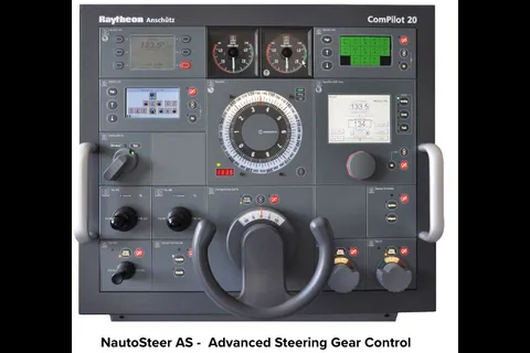
Autopilots & Steering Systems
Supply, installation and support of Raytheon Anschütz autopilots and steering systems as authorized dealer and service depot.