Woods Hole Group Remote / Digital Service
SARWind
Broad-area offshore wind resource statistics from CLS satellite observations and high-resolution wind modeling, combinable with DeepCLiDAR data.
Description
SARWind applies the CLS Group's expertise in satellite radar observations and high-resolution wind field modeling to provide broad-area offshore wind resource statistics and data, which the company says give greater accuracy and spatial definition than hindcast models.
Key features
- Broad-area wind statistics from satellite radar observations
- High-resolution wind field modeling
- Can be combined with site-specific DeepCLiDAR floating lidar data and in-situ metocean measurements
Applications
Offshore wind resource assessment supporting decisions throughout the life of a wind energy project.
More from Woods Hole Group
- NEMO Vessel Monitoring System
- Themis Fleet Tracking
- DeepCLiDAR Floating LiDAR Buoy
- Metocean Measurement & Consultancy Services
- Argos Satellite Telemetry
- Environment & Climate Consulting
- THEMIS Fisheries Monitoring Center
- Fisheries E-Logbooks
- Maritime Awareness System (MAS)
- LRIT & SSAS Solutions
- Oil Spill Monitoring
- EddyWatch
Featured services
All services →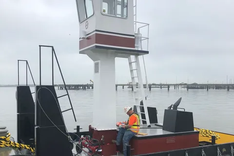
Rental / Leasing
Truckable Tug Chartering
Charter of 600 HP twin-screw truckable push boats with a hinged pilothouse for road transport to rivers, lakes and remote reservoirs.
Other service
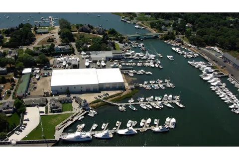
Dockage and Moorings
Seasonal and transient dockage and moorings at the Crosby Yacht Yard marina in Osterville, Cape Cod, with a fuel dock on site.
Engineering & Design
General Dynamics Mission Systems
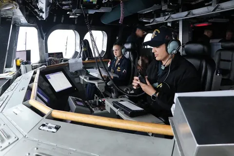
Littoral Combat Ship (LCS) Mission System Integration
Open-architecture computing infrastructure and whole-ship electronic integration for the U.S. Navy Independence-variant Littoral Combat Ship, plus NSM integration and C5I lifecycle support.