Miros Software
Offshore Wind map
Spatial map visualizing sea state and weather data from individual turbines up to multiple wind farms.
Description
Offshore Wind map is a Miros Cloud application that lets operational teams view real-time sea state and weather data in a spatial map, from individual turbines through to multiple wind farms in one view.
Key features
- Real-time sea state and weather data on a map
- Scales from a single turbine to multiple wind farms
- Single view for operational teams
Applications
Supporting safe turbine access and maintenance planning within weather limits at offshore wind farms, including crew transfer and service vessel operations.
More from Miros
Featured products
All products →
Equipment
Maxi Marine – MM
Stainless steel hot water accumulator for marine installations, used alone with an external energy source or combined with other Maxi Marine heaters; 120–15 000 L.

Equipment
Premium 3-Strand Nylon
High-tenacity 3-strand marine nylon with Marine Tech coating for dock, anchor and mooring lines; 5 mm (3/16 in) to 24 mm (1 in); white, black and navy.
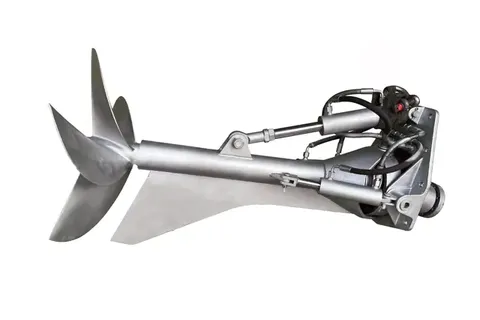
Equipment
TSD BH550 Movable Surface Drive System
BH550 movable surface drive system from TSD Surface Drive, offered with a marine engine or with electric propulsion for yachts.