Saildrone Inspection, Survey & Testing
Ocean Mapping
USV-based multibeam bathymetric mapping from nearshore to full ocean depth, with backscatter and environmental data.
Description
Saildrone provides high-resolution bathymetric mapping from nearshore to full ocean depths using its USVs.
Key features
- Deep-water and coastal multibeam echosounders calibrated to international specifications
- Sound velocity measurement and GNSS/inertial motion compensation
- Water-column backscatter and environmental data collection
- Hull designs optimized for multibeam acquisition in high sea states
- Data delivered to the Mission Portal or directly into hydrographic and GIS workflows
Applications
- Coastal and deep-ocean mapping
- Cable route surveys
- EEZ exploration mapping
More from Saildrone
- Saildrone Spectre
- Saildrone Mission Portal
- Saildrone Surveyor
- Saildrone Voyager
- Saildrone Explorer
- Saildrone Fully Managed Mission-as-a-Service (MAAS)
- Saildrone API
- Saildrone Maritime Domain Awareness
- Saildrone Undersea Detection
- Saildrone Sub-bottom Profiling
- Saildrone Metocean Survey
- Saildrone Kinetics and Effectors Integration
Featured services
All services →Rental / Leasing
Liquid Mud Barge Charter
USCG-designed and approved liquid mud barges with four compartments and on-board piping and pumps for Grade "D" and "E" nonhazardous drilling fluids.

Other service
Cannes Yachting Festival
Six-day in-water boat show each September in the Vieux Port and Port Canto, Cannes; the 2024 edition showed more than 700 boats of 5 to 45 metres.
Engineering & Design
General Dynamics Mission Systems
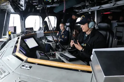
Littoral Combat Ship (LCS) Mission System Integration
Open-architecture computing infrastructure and whole-ship electronic integration for the U.S. Navy Independence-variant Littoral Combat Ship, plus NSM integration and C5I lifecycle support.