Massachusetts Maritime Academy Inspection, Survey & Testing
Hydrokinetic Test Site
Tidal energy test site on the Cape Cod Canal with a 600’ deep water pier and an 8-ton hydrokinetic test barge.
Description
Massachusetts Maritime Academy sits on the Cape Cod Canal, which is 480 feet across, about 7 miles long and at least 35 feet deep. The canal current changes direction every six hours and can reach 5.2 miles per hour, and the Academy uses these conditions to support feasibility studies and demonstrations of hydrokinetic power systems.
Key features
- Existing 600’ deep water pier
- 8-ton, 25 x 35 ft aluminum catamaran test barge with a 17 ft wide center well and a lifting crane for deploying and recovering tidal turbines
- Support from two assist harbor tugs, an 85’ supply/tow boat and inflatable rescue boats
Applications
- Tidal and hydrokinetic turbine testing and demonstration
Specifications
| Canal width | 480 ft |
|---|---|
| Canal depth | min. 35 ft |
| Max current | 5.2 mph |
| Pier | 600 ft deep water pier |
| Test barge | 8 t, 25 x 35 ft aluminum catamaran, 17 ft center well |
More from Massachusetts Maritime Academy
- Graduate Programs
- Training Vessel Fleet
- Offshore Wind Safety Training (GWO BST)
- SSV Ernestina-Morrissey Programs
- Marine Engineering (MENG)
- Marine Transportation (MTRA)
- Energy Systems Engineering (ESEN)
- Facilities Engineering (FENG)
- International Maritime Business (IMBU)
- Marine Science, Safety, and Environmental Protection (MSSEP)
- Sea Term aboard NSMV Patriot State
- Advanced Shiphandling in Manned Models
Featured services
All services →
Other service
Cannes Yachting Festival
Six-day in-water boat show each September in the Vieux Port and Port Canto, Cannes; the 2024 edition showed more than 700 boats of 5 to 45 metres.
Rental / Leasing
Inland Push Boat Chartering
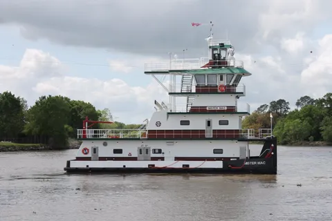
Charter of inland push boats from 600 HP to 2200 HP, including the 2200 HP M/V MISTER MAC with twin Mitsubishi S12R Tier III engines.
Inspection, Survey & Testing
Benthic Habitat and Seafloor Mapping (Great Lakes Lakebed 2030)
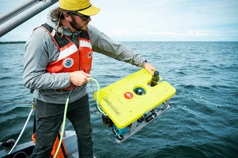
Multi-office NOAA project collecting airborne lidar and multibeam sonar data to map Great Lakes nearshore benthic habitat (0-80 m) in support of Lakebed 2030.